Our Projects
Our main projects are listed below. Click on each to see further details (and within those details there is a link that zooms into our map to show the area of the project, and what has been implemented).
To see our whole map with the project areas shown, click here.
Completed
Root cause under investigation
Awaiting Business Case / Funding
Not Feasible or Cancelled
Other key achievements of the PVFF
Since its inception in 2013, the PVFF has also:
- Promoted and established a superb working relationship with communities across the Pang Valley and beyond.
- Represented the interests of the River Pang and its catchment on the South Chilterns Catchment Partnership and as part of the DRY project with Loughborough University.
- Held a Flood Fair (2016) for residents across West Berkshire (attended by Flood Re and other Flood risk Product companies) and raised awareness of flooding issues and a Flooding Workshop (March 2019) run in conjunction with the University of Reading, with information stands from Flood Re, Thames Water, the EA, WBC, and Action for the River Kennet and attended by over 100 residents and interested parties, to look at flooding in the Pang Valley in the past, present and future.
- Gained Grants for Flood Emergency equipment.
- Gained a grant that helped seed fund bank re-instatement work at BBOWT’s Moor Copse reserve to reduce overbanking and consequential flooding.
- Given talks to Parish Councils and interested residents, encouraged residents to have their own flood plans and PLP.
- Helped other Flood Groups set up or improve their ways of working.
- Attended flood seminars and conferences to stay abreast of new developments.
- Worked with partner organisations to improve the watercourse and river channel in Compton.
- Developed our own website, logo etc with, amongst other things, a library of useful documents and live (and historic) river and groundwater graphs.
- Produced our own "Guide to being a Flood Warden".
- Documented mill and sluice operating procedures for all key mills and sluices in the valley.
- Documented all Actions to reduce Flood Risk (Part of the West Berkshire Flood Risk Management Plan) whether completed or open on a live document on the website.
- Were "Highly Commended" as a Community Group by West Berkshire Council in 2016.
- Are a key project partner for the Reading University NERC LANDWISE project and have supported academic investigations by various students in to Flood related topics.
- Were 'Highly Commended' in the 'Community Partnerships' category at the EA's Flood and Coast Excellence Awards 2022.
- Hosted 14 Japanese visiting Professors and Researchers from the Prefectural University of Kumamoto as part of their NFM research (2023).
- Presented at the Thames RFCC conference 2023 on our NFM projects.
- Hosted a Flood Protection Exhibition event (2024), attended by 200+ guests from around the Thames Valley, in conjunction with Project Groundwater, Thames Water, Environment Agency, West Berkshire Council and Flood Mary.
- Created and now host a National Flood Map showing map layers from the Environment Agency, British Geological Survey, Natural England, the Land Registry.
- Created and now host a maps and dashboards for other Flood Groups: Lambourn, Marlborough, Purley on Thames, Newbury.
Bucklebury Waven field scheme Back to top
Completed 2025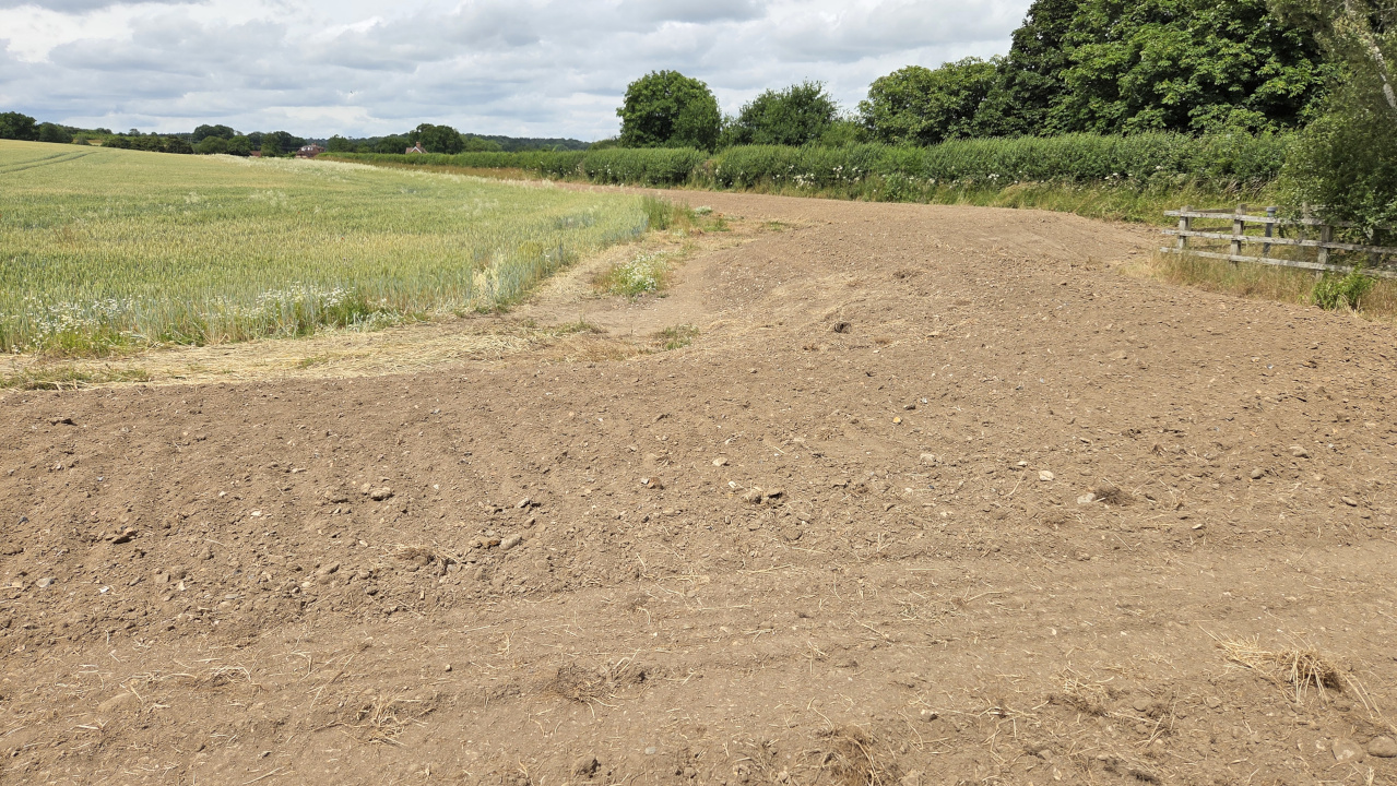
Objectives
Bucklebury Village has sometimes suffered from surface water flooding during winter storms when the groundwater has been high. The surface water runs off the hill and field to the south west of the village, entering the village by the Thames Water pumping station next to the house Waven. On each occasion, the road drain network could not cope with the inflow and water lapped at the edge of properties. Only by pumping with a tractor and a 8,000 litre tanker was actual property flooding averted.
This flood scheme has been designed to alleviate the risk from water flowing off the Waven field into Bucklebury Village.
Funding and Leadership
The project was funded by a grant from the Thames Regional Flood and Coastal Committee (RFCC), allocated for NFM projects. The project was sponsored by West Berkshire Council and kindly managed by Bucklebury Estate. Bucklebury Estate and their tenant farmer also generously supported the project by allowing the land to be used for the scheme.
The design - using the local geology
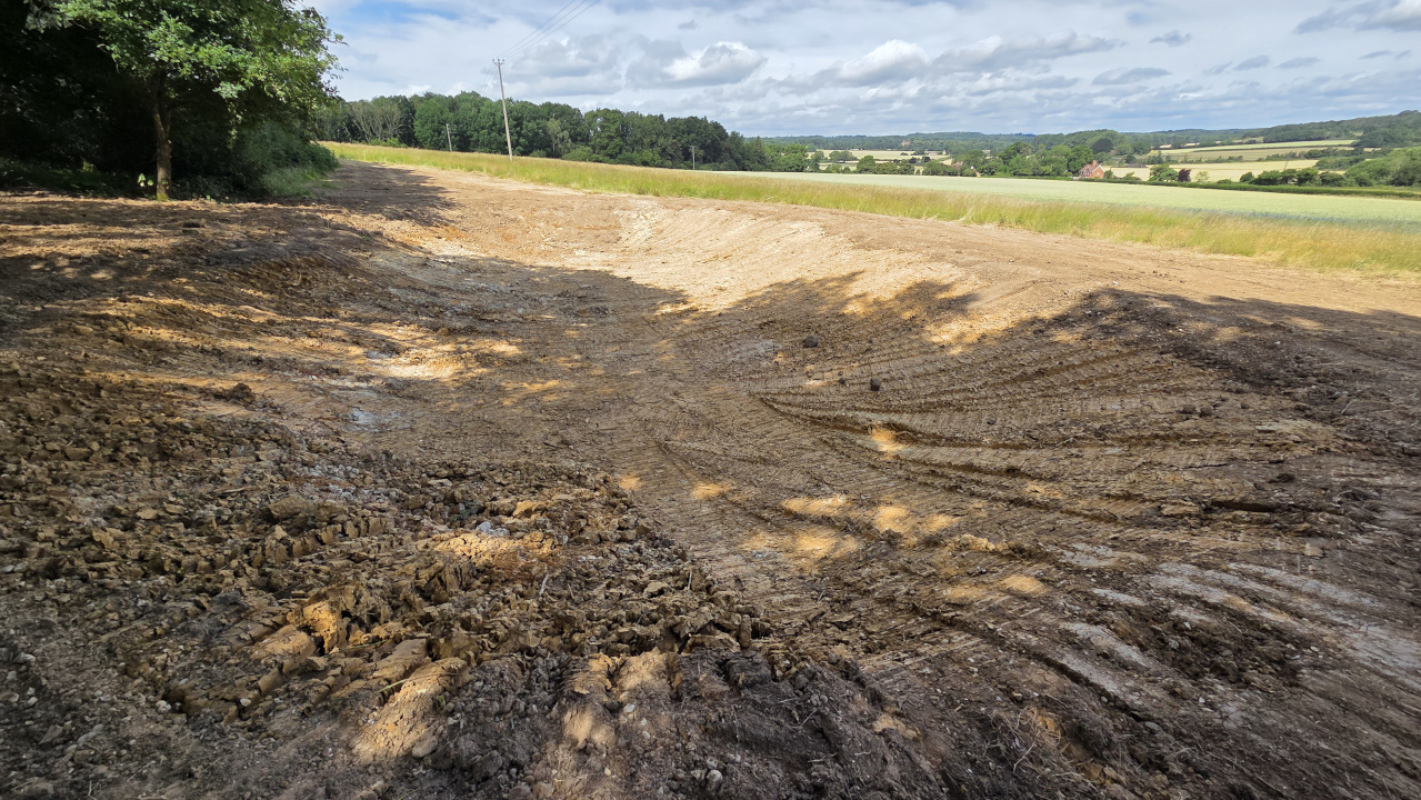
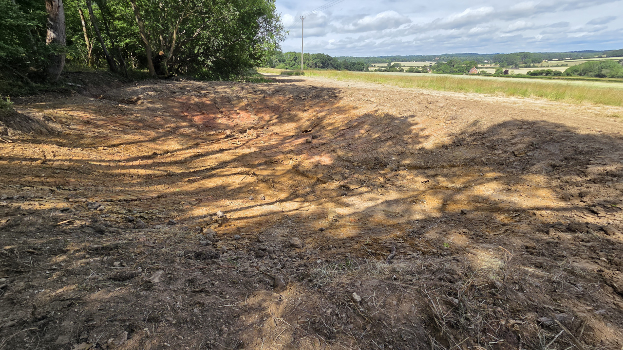
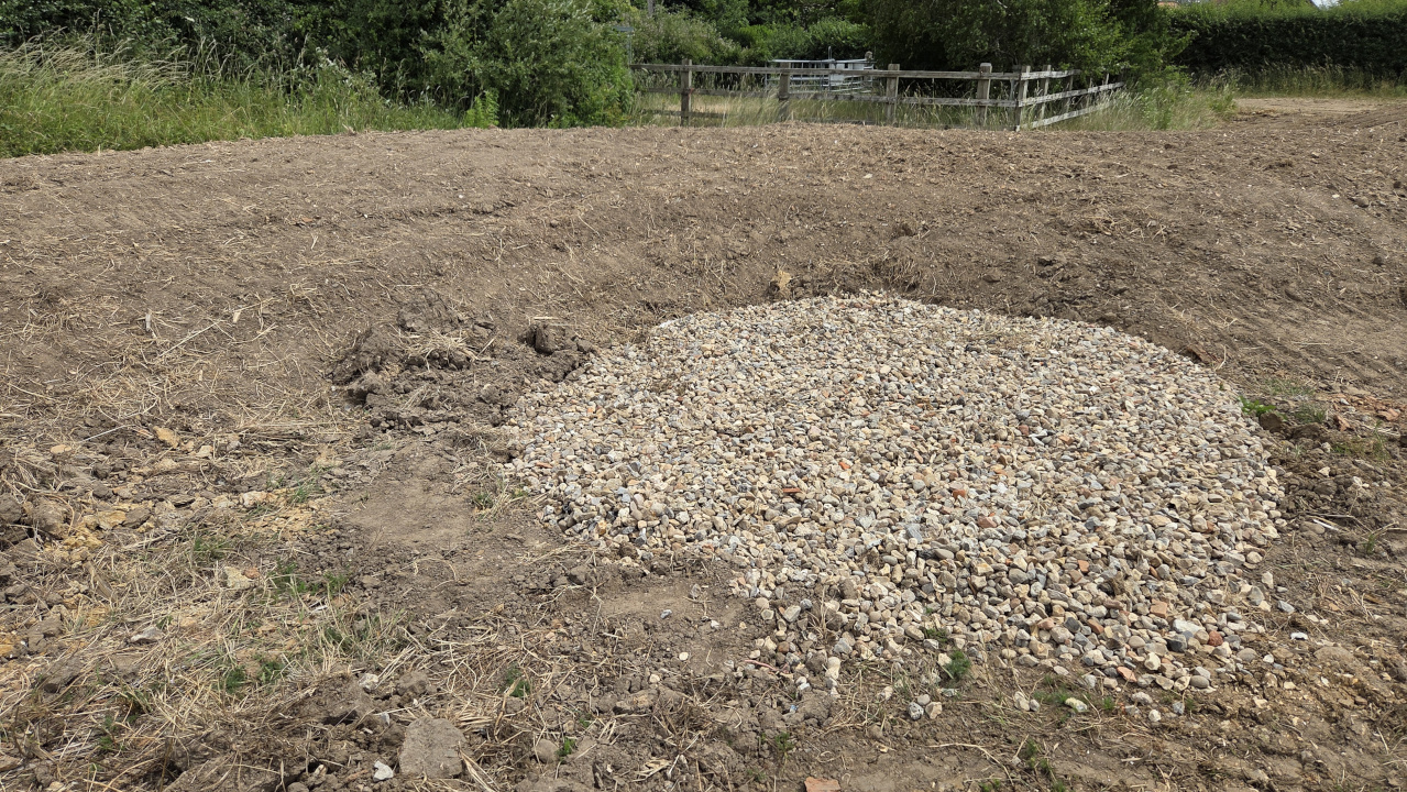
At the top of the Waven field, by the wood to the south, the land is clay. At the bottom of the field, the bedrock geology is chalk with sand gravel deposits. To stop the water flowing into the village, the scheme has constructed the following: 2 holding ponds have been dug at the top of the field, on the edge of the wood, in an area that becomes boggy in wet winters; the clay dug out of those ponds has then been used to construct a 0.80m high embankment around the Thames Water pumping station at the bottom of the hill. This embankment tapers into the hill at the 67.20m contour. This embankment will hold surface water run off. By the embankment a soakaway pit has been dug to a depth of 2.5m, giving direct access to the permeable strata, and that pit was filled with shingle.Thus in the event of another 'Storm Dennis' like event, the embankment will fill with the water running off the field and hill. After the storm it will then soakaway into the chalk and gravel beneath.
The embankment can hold back 1430 m3 of water (1,430,000 litres).
Design and Construction
The PVFF and Bucklebury Estate designed the scheme, using the Environment Agency LIDAR data and known embankment designs and construction requirements from historical experience within the water and civil engineering industry.
Construction of the ponds and embankments was carried out by SJB Contracting for Bucklebury Estate.
Redhill Copse Natural Flood Management Back to top
Completed 2023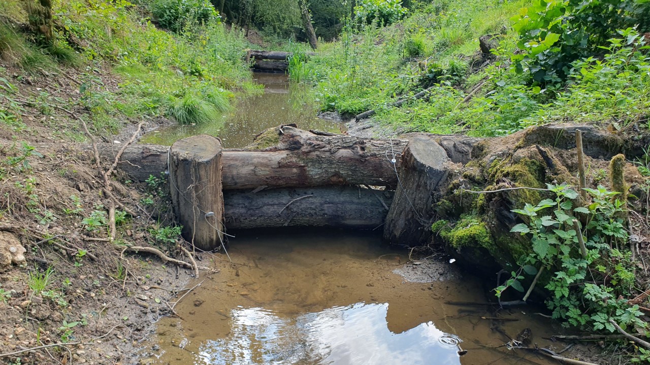
See the Redhill Copse leaky dams in use on this video, 12 hours after 34mm of rain fell on 20/09/2023.
Objectives
As with our other NFM projects, this NFM project has aimed to reduce the peak flows from one of the fast reacting tributary streams that flow off the clay ridge to the south of the River Pang. In this case, the project has focused on Osgood's Gully stream as it flows through Redhill Copse. This is the fastest reacting tributory stream after intense rain events. We followed the Environment Agency's Natural Flood Management (NFM) strategy to implement natural techniques to slow the flow, to hold back water and to reduce the height of peak flow levels.
Funding and Leadership
The project was funded by a grant from the Thames Regional Flood and Coastal Committee (RFCC), allocated for NFM projects. The project was sponsored by West Berkshire Council and kindly managed by Bucklebury Estate.
Improving the Environment
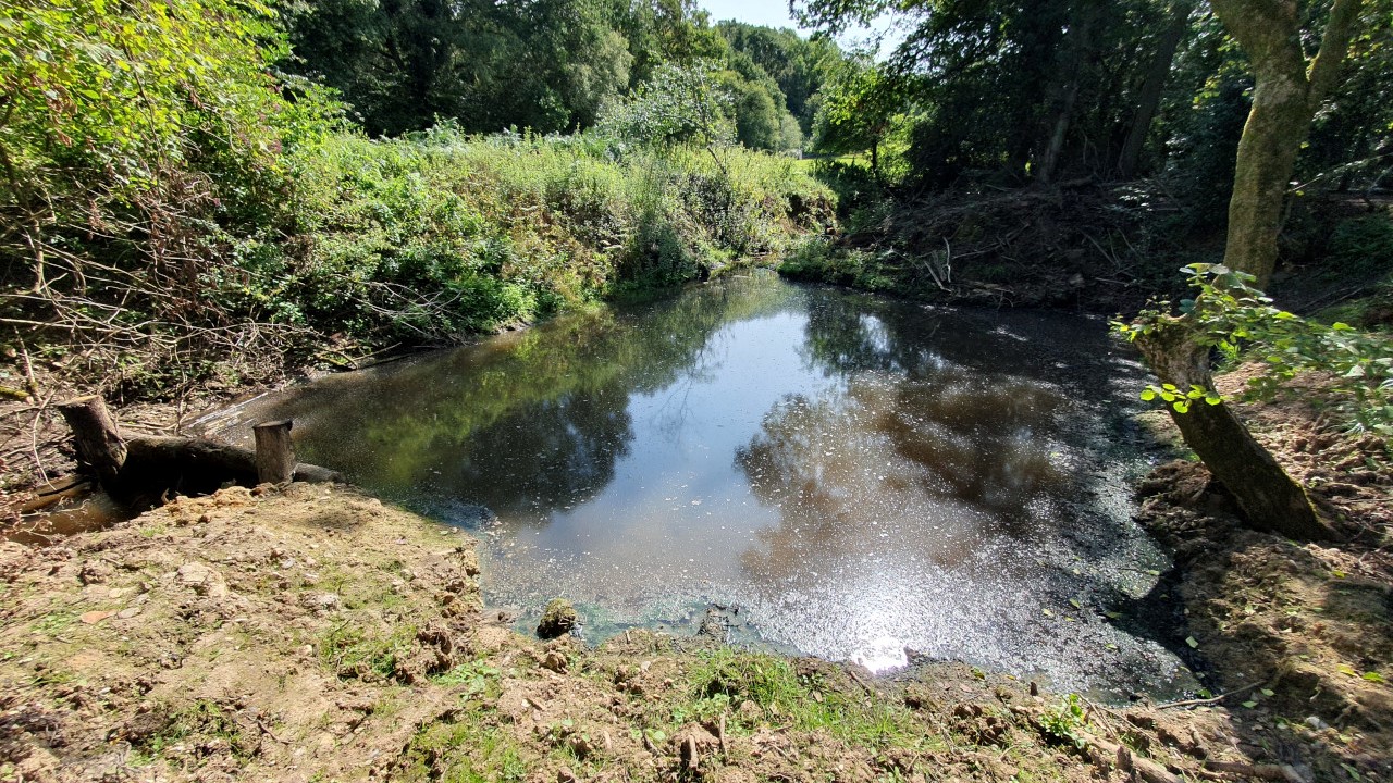
Bucklebury Estate was already conducting a project to improve the biodiversity on Bucklebury Common, involving the reinstatement of historic ponds, the thinning of overgrown woods and the opening up of areas to natural light. The Estate kindly approached the Pang Valley Flood Forum to ask how we might work together to reduce flood risk. The Flood Forum had already noted the potential for NFM leaky barriers in the Redhill Copse area and thus suggested that opportunity.
The Redhill Copse area was within the Estate's planned woodland management project. The project thus coordinated the thinning and felling of suitable trees with the NFM work, so that the same machinery and delivery team could be used for both (thereby reducing carbon costs of machinery). Oak logs felled in the thinning project were then used on site for the construction of the leaky dams.
Design and Construction
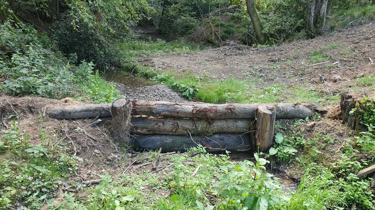
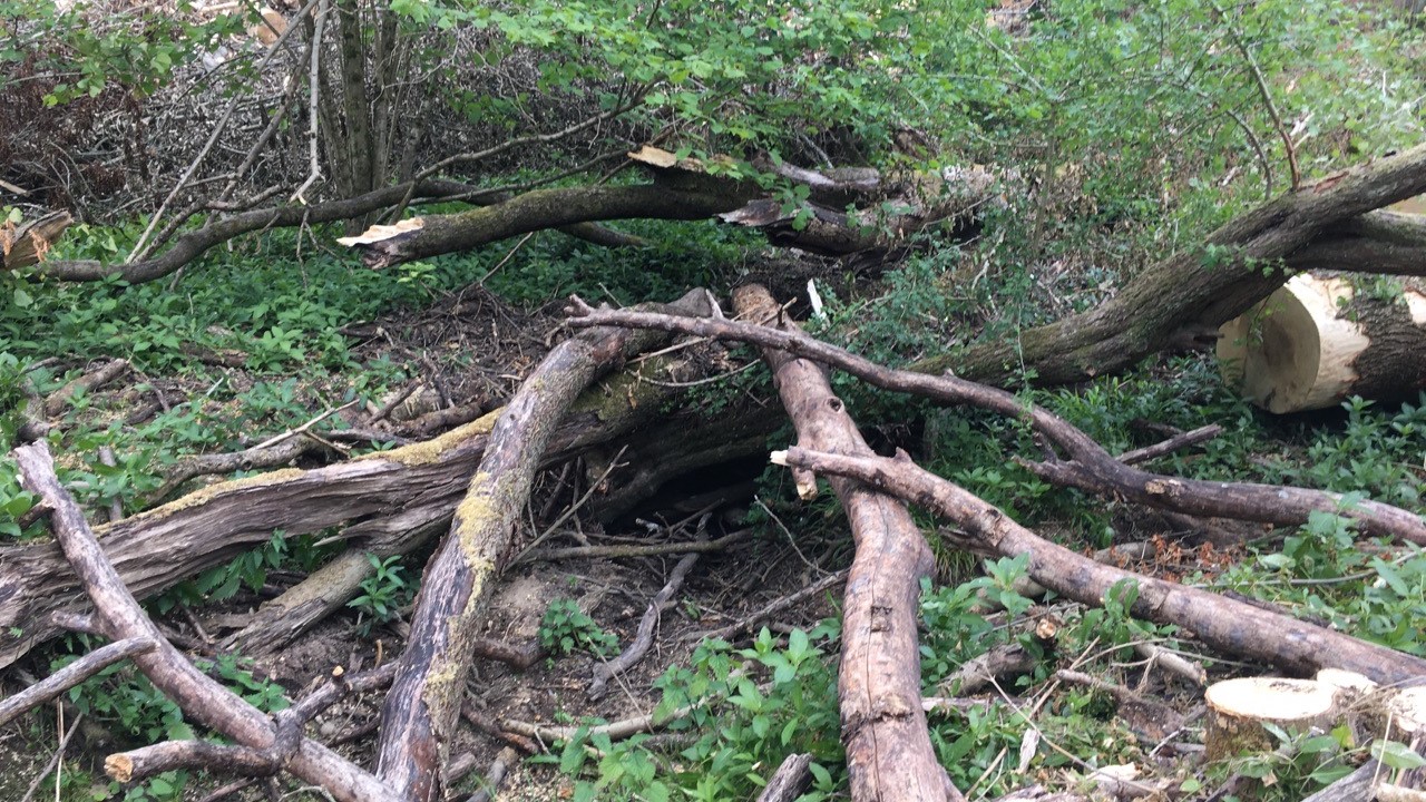
The PVFF and Bucklebury Estate team mapped out suitable points for 13 leaky dams and silt trap pond area and then on the ground with a study of the actual topology and tree locations.
The previous PVFF NFM projects had implemented leaky dams of a less formal construction that we had observed being less able to hold back water in low and medium flow scenarios. For this project we choose to use a more rigid and structured leaky dam design, seen in other projects outside of the Pang Valley. These then required vertical posts of oak, three tidy horizontal oak logs, with the bottom log being embedded into the ground to reduce seepage underneath. The horizontal logs were embedded into the channel banks and secured with wire to the vertical logs.
Construction of the dams was carried out by the Bucklebury Estate forestry team, who had been working in Redhill Copse.
Elmwood Natural Flood Management Back to top
Completed 2020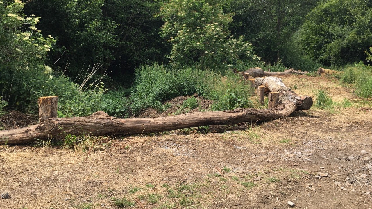

Objectives
As with our project on the Bourne, this NFM project has aimed to reduce the peak flows down the Elmwood Stream (the largest tributary into the Pang upstream of Bucklebury Ford) after intense rain events. We have followed the Environment Agency's Natural Flood Management (NFM) strategy to implement natural techniques to slow the flow, to hold back water and to reduce the height of peak flow levels.
Funding and Leadership
The project was funded by a DEFRA NFM Grant (administered by the Environment Agency), specifically allocated for community level groups to use on NFM projects. The project was managed by an experienced volunteer from within the PVFF, and with the support of The Marlston Estate, through which the Elmwood Stream flows.
Design and Construction
The PVFF team chose this catchment following a study of the key inflowing stream catchments that contribute large flows to the Pang from the clay layer on the Bucklebury ridge.
The project has implemented 24 'leaky dams' on the Elmwood Stream. Construction of the dams was carried out by Englefield Forestry having gained experience on the River Bourne project.
Additional measures included log barriers and "dragon's teeth" to prevent 4x4 access to the stream which has caused damage over the years through misuse, doubling up as leaky dams.
Bourne Natural Flood Management Back to top
Completed 2019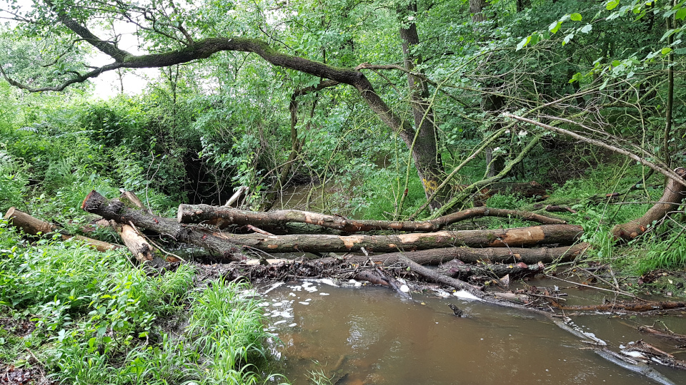


Objectives
This natural flood management project has aimed to reduce the peak flows down the Bourne (the largest tributary into the Pang upstream of Tidmarsh) after intense rain events. We have followed the Environment Agency's Natural Flood Management (NFM) strategy to implement natural techniques to slow the flow, to hold back water and to reduce the height of peak flow levels.
Funding and Leadership
The project was funded by a DEFRA NFM Grant (administered by the Environment Agency), specifically allocated for community level groups to use on NFM projects. The project was managed by an experienced volunteer from within the PVFF, and with the support of Englefield Estate, through which the Bourne flows.
Design, Construction, Monitoring
The project has implemented 38 'leaky dams' on the River Bourne. Construction of the dams was carried out by Englefield Forestry with advice from the Environment Agency (with expertise gained in the Stroud Area). Additional works included: bank reinforcement and protection measures to limit runoff and erosion from a forestry track.
A Reading University team conducted flow monitoring.
A post construction River Habitat Survey and Modified Condition Assessment survey was completed in November 2020.
Publicity
The project was featured on BBC South Today.
Project Report
Download the final project report (warning, it's 25Mb zipped).
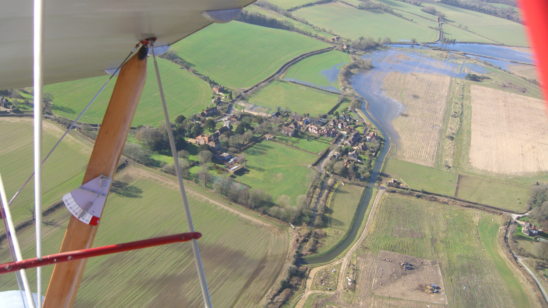
Pang Valley mapping Back to top
Completed 2016 and evolved ever since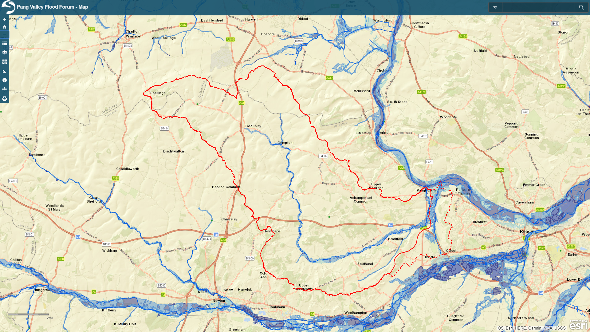

Objective
The project aimed to create a shareable map available online that combined map data from the EA, WBC, the British Geological Society and specific map information gathered by the PVFF itself.
Result
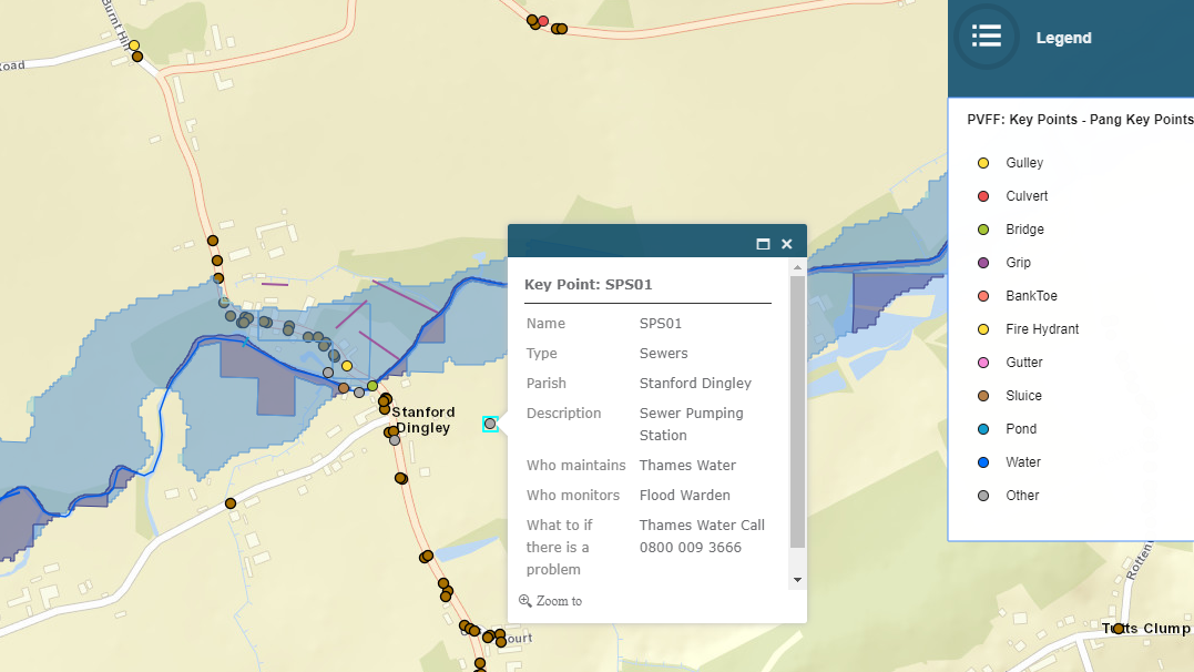
Parish representatives through the valley mapped:
- Key Points that should be monitored
- Slow/Fast areas where the water should be slowed or sped up.
The PVFF team have used this information as the basis for valley wide maintenance plans and to identify opportunities for 'slow the flow' natural flood management projects.
Mapping
The PVFF team used Google My Maps to create a framework through which parish representatives could record the locations of the Key Points in their own area, and could record "Who maintains", "Who monitors" and "What to do if there is a problem" at each point.
A similar mechanism was used to map the recommended slow and fast areas in the valley and this map layer was enhanced with aerial photos taken during the floods of Feburary 2014.
The resulting PVFF map layers have then been combined with map layers from others sources and are presented through ESRI's ArcGIS online platform.
Map Evolution
The PVFF map is now continually evolved. The numbers of map layers has grown and includes many layers created by PVFF, layers from other parties and layers created by PVFF by combining data from other parties (such as the "Property Flood Risk" layer, which combines data from the EA and the Ordnance Survey). We don't use Google My Maps anymore for our own layers, but hold our map layer data in MySQL along with our river / groundwater / rain data.
The PVFF now also host a National Flood Map.
Links
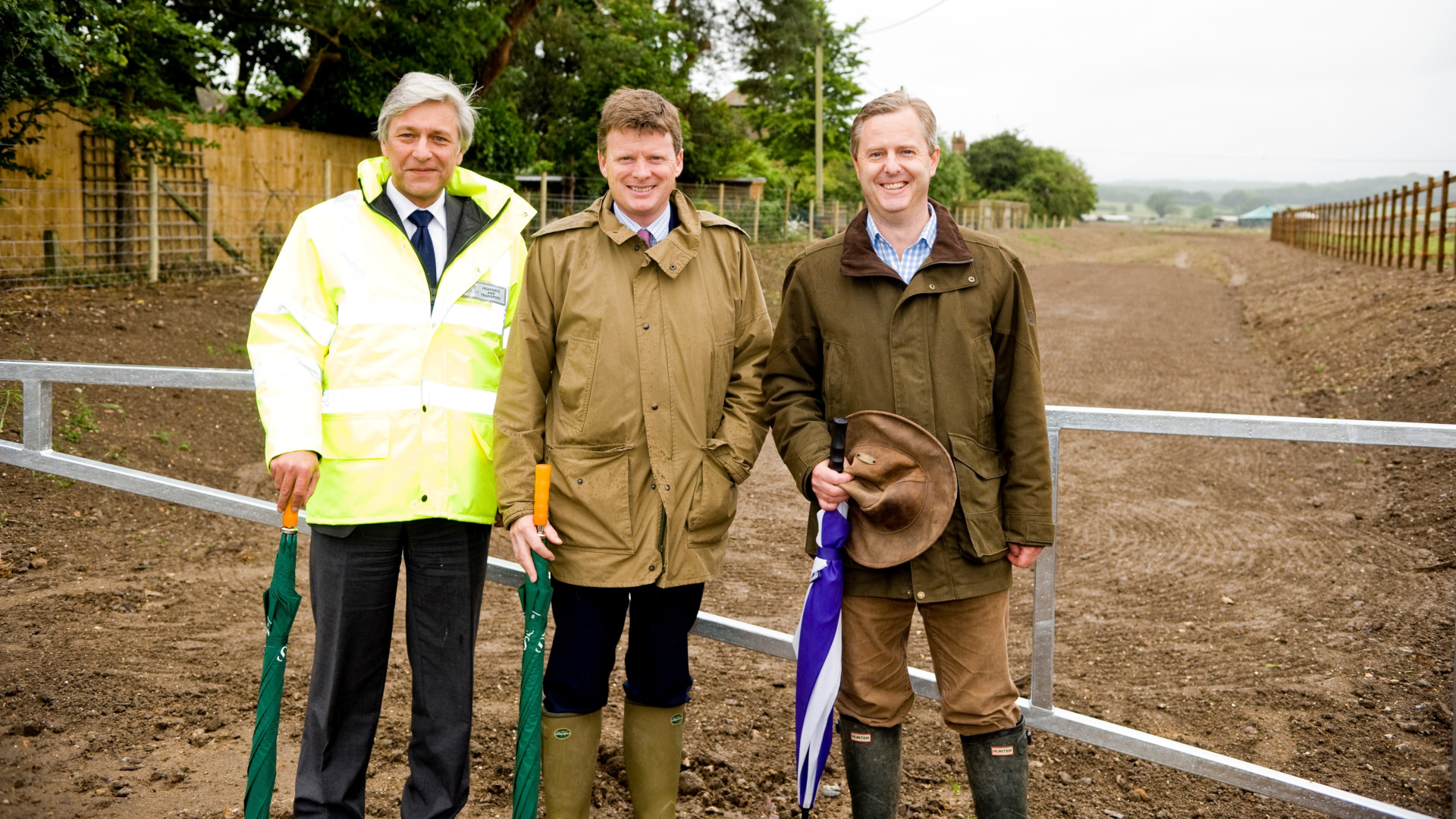
Bucklebury Flood Alleviation Scheme Back to top
Completed 2011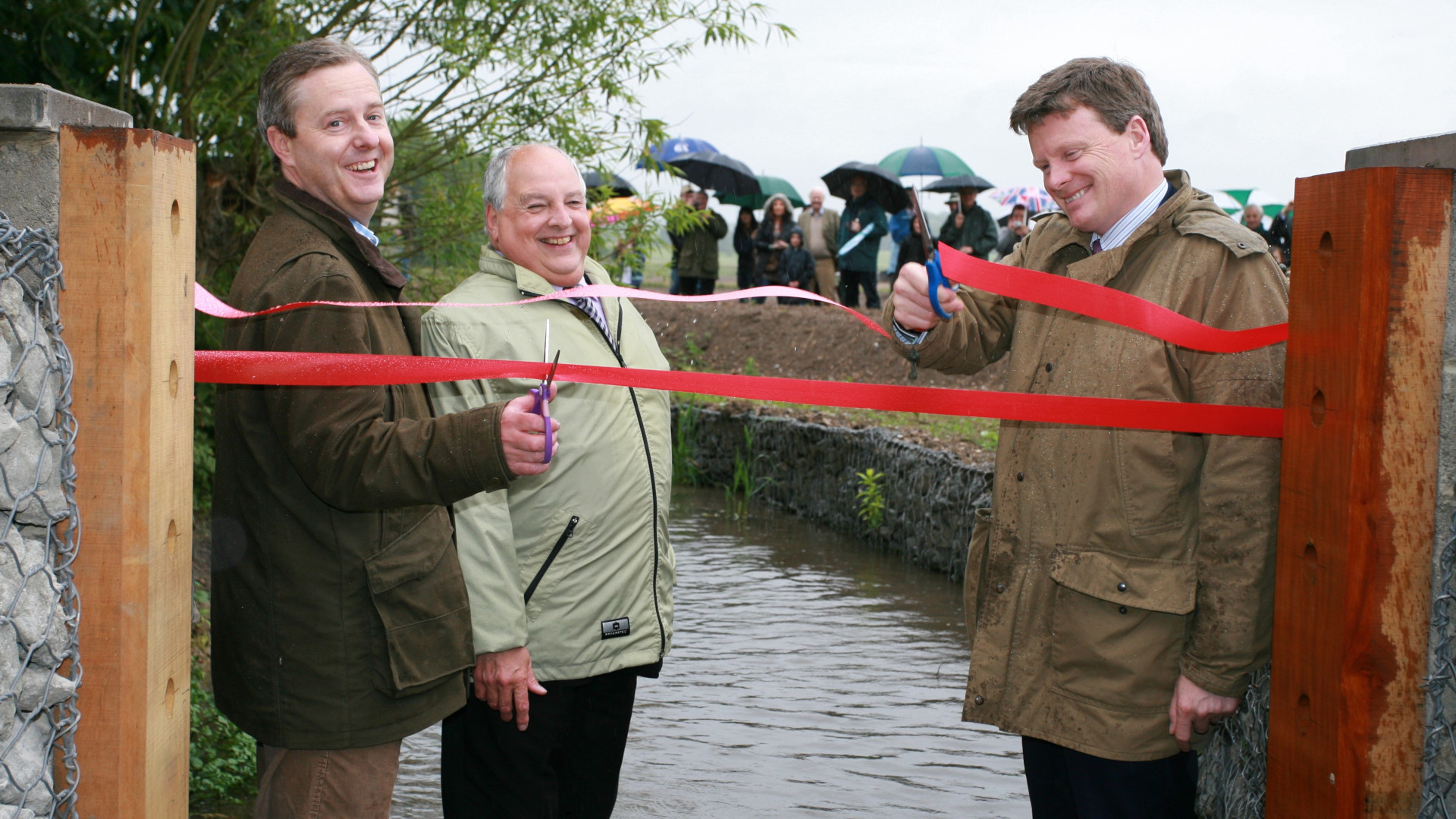
Objective
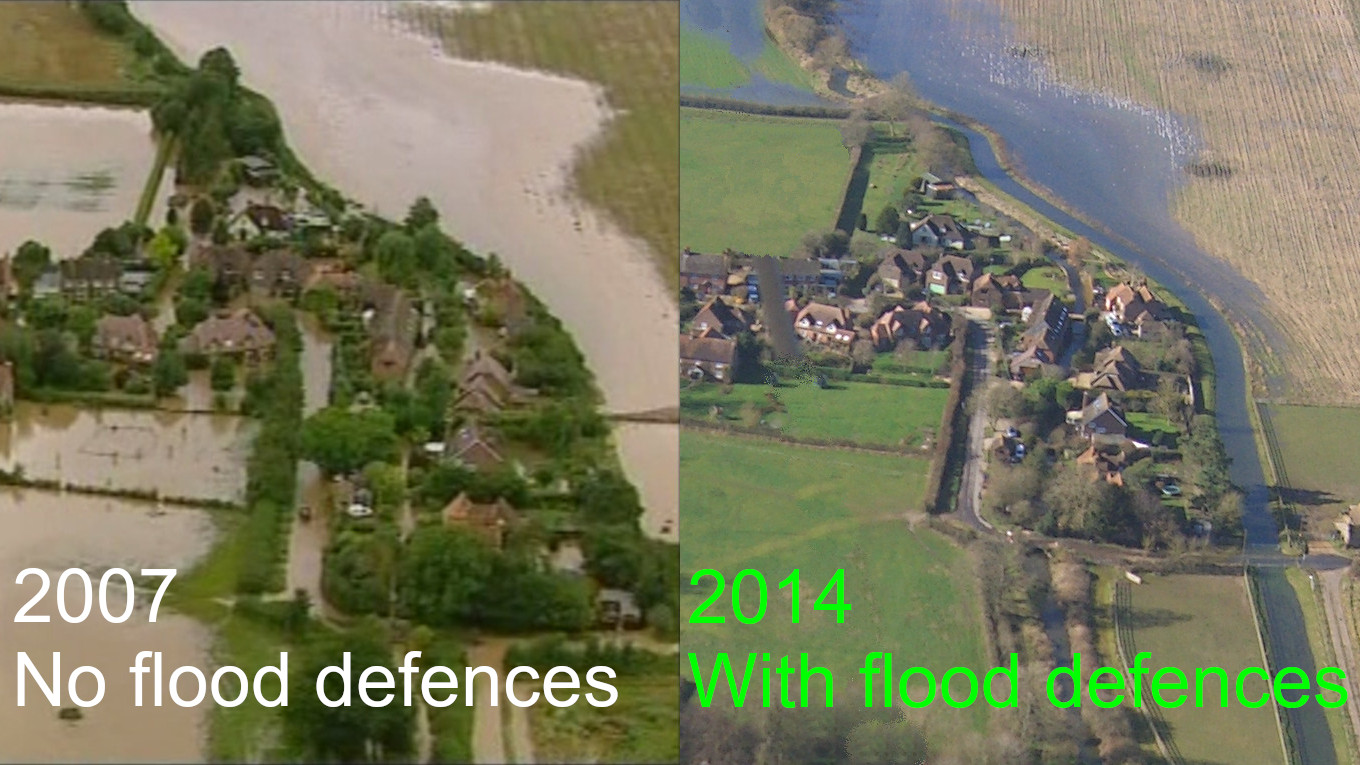
The project aimed to reduce the risk of flooding in Bucklebury Village following widespread property flooding in 2007, while ensuring that flood risk was not increased in Stanford Dingley downstream.
Result
The scheme was opened in 2011 by the Flood Minister Richard Benyon MP and village project lead Piers Allison. The scheme was designed by Peter Brett Associates to provide a standard of protection to properties of 1 in 154 (0.6%) annual exceedance probability. In February 2014, it proved its worth when the River Pang reached 2007 levels for several weeks and not a house got wet.
Design and Construction
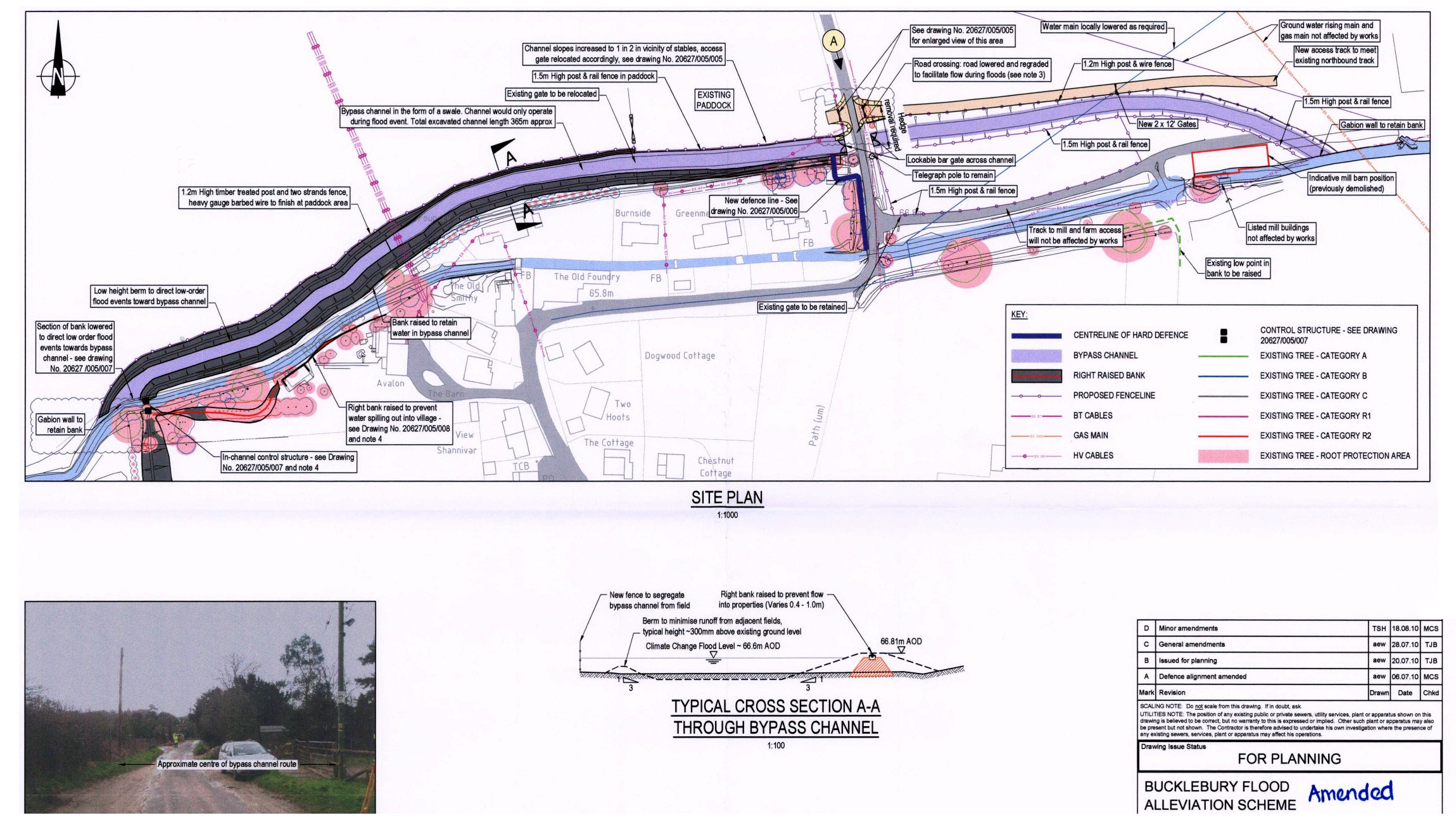
The scheme includes flood embankments, a bypass channel and a new 'dry' ford to divert flood flows around the village. It also includes a further embankment downstream to ensure the flood risk is not increased in Stanford Dingley. Despite the construction phase experiencing a terrible winter, the scheme was delivered incident free in April 2011.
Funding and Support
The project was funded by the Thames Regional Flood Defence Committee with contributions from the villagers and West Berkshire Council. The vilagers formed a Community Interest Company and had a contract with the Environment Agency to manage the delivery of the project. Thanks also go to the local landowners (Bucklebury Estate and New Barn Farm) that enabled the project.
Detailed Plans and Media
- Flood Scheme design
- Flood Scheme plans
- Landscaping plans
- 2010 Reading Chronicle
- 2010 Newbury Weekly News
- 2011 Civil Engineer
- 2011 Newbury Weekly News opening ceremony
Delivery Partners
Stanford Dingley sewers Back to top
Root cause under investigation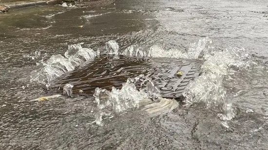
The Problem
At times of high rainfall or high local groundwater, the Thames Water owned sewer network, that starts in Frilsham and flows to Stanford Dingley, floods and overflows into the road, gardens and houses in Stanford Dingley. This sewage overflow, albeit diluted with rain / groundwater, then flows into the River Pang, polluting an important chalkstream.
Flooding Observation
In 2014, a local resident observed that the sewer flooding produced wheelbarrows of fine sand that came out of the manholes following major storms.
Geology
Overlaying the route of the sewer network over the local geology, shows that in the vicinity of the Pot Kiln, the sewer runs through the 'Reading beds', a geological layer that contains fine sand. In this section the sewer runs underneath a stream and several sinkholes.
Finding the source of ingress
We know there is ingress of storm or groundwater into the sewer network. Thames Water have manhole monitors, which monitor the height of the sewer flow at specific points and these have shown that ingress is occurring. However, although this data has been provided to the PVFF, it is sporadic and incomplete and does not allow us to determine the exact area of ingress.
Data Analysis
We have overlaid on graphs, the spikes of flow and the recorded occasions of sewer overflow against rainfall and groundwater levels (note that Thames Water themselves have not conducted such sophisticated analysis). These charts are shown on our Sewage Discharge dashboard. The monitoring data is not yet sufficiently complete to identify the exact source of ingress.
It appears that on some flooding occasions there is an ingress surge from the Burnt Hill pumping station, and on other occasions there is ingress somewhere between the Burnt Hill confluence and a manhole upstream of the Pot Kiln.
Hampstead Norreys bypass channel Back to top
Awaiting Business Case / FundingObjective
The project will construct a flood bypass channel to divert significant volumes of flood water (that would otherwise overflow within the village), before rejoining the river downstream near the highway culvert on the B4009 Church Street.
The design modes show that the scheme would mitigate the risk of flooding to all existing properties within the beneficial area from a 1 in 20 year flood event, i.e. a flood event similar to the event in February 2014. The proposed maximum flood extent during a 1 in 100 year plus 35% climate change event will also be reduced to a similar extent of the existing 1 in 20 year flood event along Water Street.
Proposed Design
The proposed Flood Alleviation Scheme (FAS) comprises a flood diversion channel, similar to the temporary diversion channel created in 2014, located within the arable fields to the east of the village. This will redirect flows away from the residential area along Water Street where the Pang currently flows.
The proposed FAS will also introduce a small check dam with flow control in the main channel to reduce the flow from entering the channel along Water Street during high flow events.
Stanford Dingley bypass channel Back to top
Awaiting Business Case / Funding
Objective
The scheme will provide a standard of protection to properties of 1 in 75 (1.33%) annual exceedance probability from river flooding.
A number of environmental enhancements are proposed as part of the scheme which will be finalised at the detail design stage.
Project Delivery
West Berkshire Council (WBC) will project manage the design and construction of the scheme using their in-house engineering team. WBC will appointed a consultant to carry out the detailed design and a contractor to deliver the scheme on site.
Proposed Design
The design comprises an overflow/bypass channel in combination with a ford upstream of the Mill Bridge. The aim of this proposal is to divert significant volumes of flood water (that would otherwise overflow within the village), before rejoining the river downstream of the bridge.
The scheme includes:
- Flood relief channel with ford
- Reprofile South End Road with associated swale
- Provision of raised kerbs at two locations
- Regraded existing ditch to fall towards the River Pang.
Upper Pang Valley groundwater scheme Back to top
Cancelled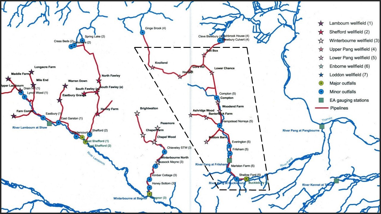
West Berkshire Groundwater Scheme
The West Berkshire Groundwater Scheme shown on the plan is a network of pumps and connecting pipelines designed to abstract groundwater in times of drought in order to augment river flow in tributaries of the River Thames, and so potentially increase the public water supply.
PVFF Proposal
The Pang Valley limb of the West Berkshire Groundwater Scheme is highlighted on the plan. It extends beyond West and East Ilsley to the north and the nine wells discharge into the River Pang downstream of Bucklebury.
Analysis of the effect on groundwater levels during 30 years of abstraction at Compton for public water supply indicated that the overall Scheme could usefully be deployed in winter to drop the groundwater level sufficient to mitigate the worst effects of flooding in the Upper Pang Valley villages.
Progress
Three MSc projects (at Birmingham and Brunel University) studied the potential for groundwater level reduction, and the downstream consequences of the discharge at Bucklebury into the higher level of river flow experienced in winter.
Those MSc projects concluded that the Scheme would have the capacity to reduce the groundwater level by ~1m after operating for a few weeks and thus to mitigate the worst effects of groundwater flooding without exposing communities downstream of Bucklebury to a significant increase in flood risk. Pumping would need to continue to the end of the groundwater season.
Reason for Cancellation
Meetings were held in December 2023 with senior members of the Environment Agency and Thames Water prior to the high groundwater winter of 2023/24. Whilst the EA admired the innovation of the proposal for this project, they deemed it unworkable as:
- The WBGWS was only licensed for drought alleviation, not for use during high groundwater.
- Some of the borehole wells were not safe to operate in high groundwater levels
- The EA doubted the MSC evaluations of the downstream flood risk impact of operating the scheme in a high river flow scenario
Following the winter of 2023/24, the PVFF analysed the periods of time during which the Pang Valley was in flood alert, which would have coincided with the time that the WBGWS would have been operated under this proposal. Alas it would have required use during Flood Alert periods for most of the time. That would not have been feasible.