Flood Guidance Statement
Issued 09:30, Thu 25 Jun 2026 (BST)
The Flood Forecasting Centre has issued a Flood Guidance Statement for an area that includes West Berkshire.
Headline Modified 09:28, Thu 25 Jun 2026 (BST)
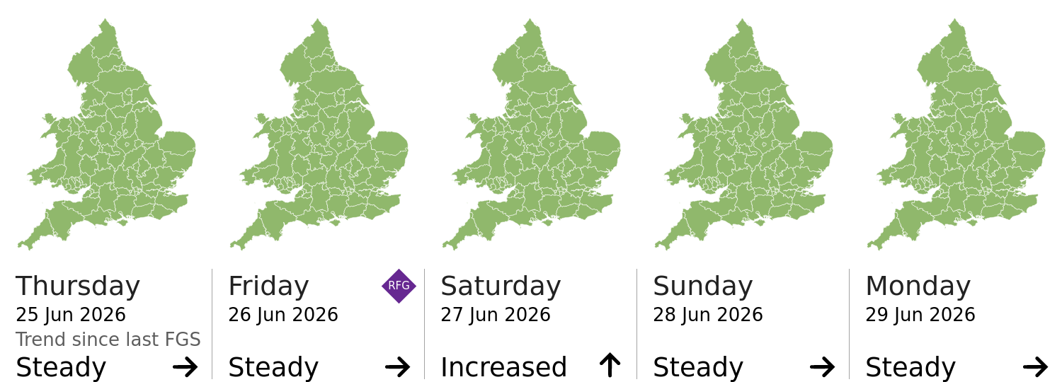
Minor surface water flooding impacts are possible for parts of England today (Thursday) and parts of England and Wales on Friday, and are possible but not expected more widely on Friday and Saturday. The overall flood risk is VERY LOW for the next five days.
Forecast Published 11:44, Thu 25 Jun 2026 (BST)
Local flooding from surface water is possible in parts of Southwest England today (Thursday) and in parts of the North of England, the Midlands and the South of England on Friday. Local flooding from surface water is possible but not expected more widely in parts of England on Friday and Saturday.
Land, roads and some properties may flood and there may be travel disruption.
Risk trend Day 1 ▶ Day 2 ▶ Day 3 ▲ Day 4 ▶ Day 5 ▶
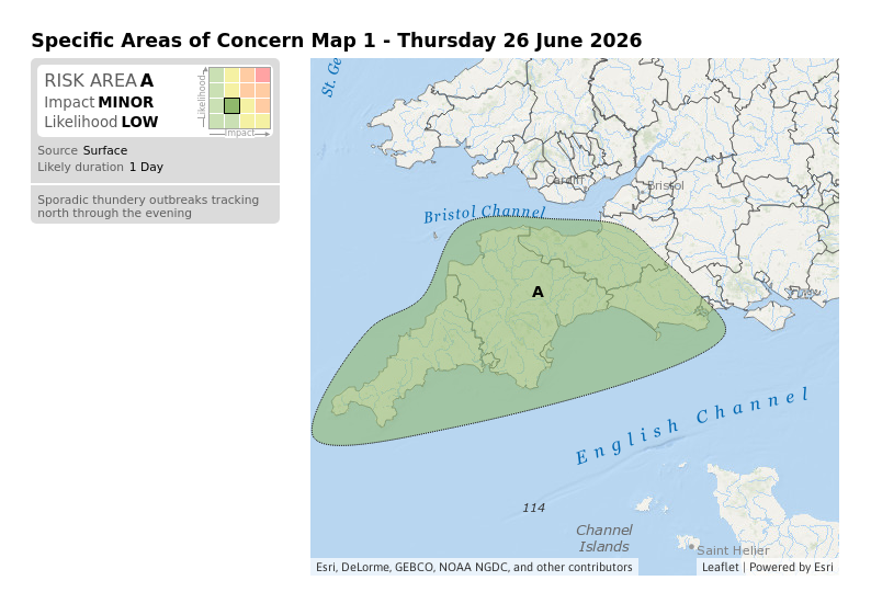
Specific Areas of Concern Map
Specific Areas of Concern Map 2 - Friday 27 June 2026
Flood warnings and alerts for the local catchments. Click the warning/alert for more information.